
Eastern Desert is dominated by the Red Sea Mountains, which form a range extending from the latitude of Cairo southward to re Egyptian-Sudanese border and beyond. These, since their presence affected events in the Nile Valley and throughout Egypt. Their origin was connection with the formation of the Red Sea. And their important role as a source of runoff and sediments contributing to the three Tertiary River systems, the Gilf, the Qena, and the Nile. As the mountains were repeatedly uplifted by tectonic forces, their streams were continually rejuvenated. The steep gradients and the abundant rainfall of earlier times combined to erode the rock layers severely. Thus, both uplift and erosion are responsible for the dramatic scenery we see today. WADI EL-T LIMES There is a huge difference between the age of the rocks in the Red Sea Mountains and the age of the Red Sea Range itself. The igneous and meta morphic rocks found in the basement complex of eastern Egypt are tremendously old: 550 to 900 million years. They were formed during a series of collisions among various crustal plates. At that time these rocks were deeply submerged within the continental crust, and they probably lay beneath a high mountain range formed by the collisions. Gradually, the ancient mountain range was eroded away. Not later than the mid-Mesozoic Era, this eroded landmass was submerged beneath an invading Tethys Sea, and the layers of Nubian sandstone and Cretaceous and Eocene limestone formed atop it. After these layers were in place, the sea withdrew and rifting began to split apart this eastern edge of the African plate. The uplift of the area to form the Red Sea Mountains probably began around 35 million years ago in the Oligocene and continued into the Miocene and Pliocene. The mountains are thus relatively young by geological standards, but contain much older rocks.
Eocene limestone forms high plateaus over a wide expanse at the northern end of the Eastern Desert. In the middle and southern parts of the mountain range, however, the upper sedimentary rock layers have been sufficiently eroded to expose the rocks of the basement complex. These rocks, especially the coarse red granites, form the rugged and lofty peaks. The tallest pinnacle in the range, Gebel Shayib, is 2,184 m high, but many others are over 1,000 m. Between the Nile Valley and the Red Sea Mountains are broad plateaus of sedimentary rocks. From Qena northward there are plateaus of Cretaceous and Eocene limestone with elevations of around 500 m. South of Qena the plateau consists of Nubian sandstone, with occasional uneroded remnants of limestone and shale forming peaks on the gently rolling sandstone surface. The Eastern Desert is intensely dissected by deep wadis and ravines that either run eastward toward the Red Sea or westward toward the Nile Valley. Since the divide between the two drainage basins lies closer to the Red Sea than to the Nile, the wadis draining eastward are short and steep. The longer wadis of the westward drainage frequently coalesce and form a small number of major trunk wadis, including Wadis el-Tarfa, el-Asyuti, Qena, Abbad, Shait, el-Kharit, and el-Allaqi.
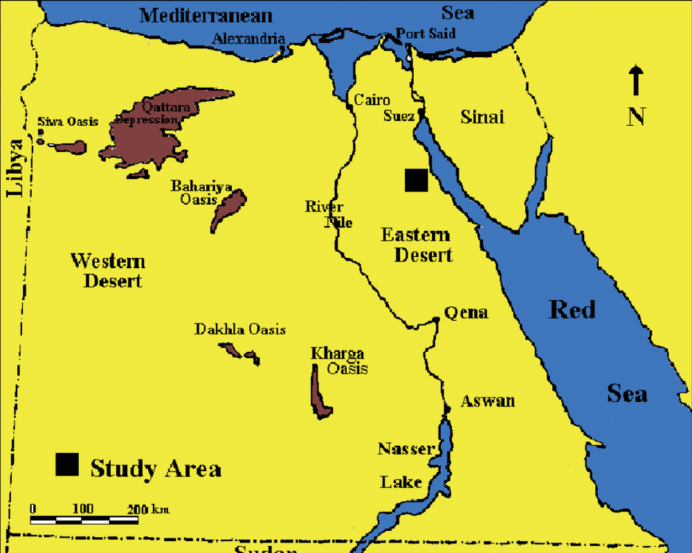
We can begin our tour of the Eastern Desert at the Cairo-Suez highway, which marks the northern end of the Desert. This route to the Red Sea is more direct than the one through the Wadi Tumilat and was followed by mining expeditions heading to Sinai as well as by Christian and Muslim pilgrims. Leaving Cairo, the road ascends to a broad plateau of Eocene limestone. In places this bedrock is covered by a spread of sand and gravel deposited during the Oligocene while this area was still near sea level. This deposit can be viewed at the Petrified Forest on the north side of the road. This area was formerly mined for its sand and gravel, but it is now protected. The winds have swept away the fine sand leaving a pavement of gravel consisting mostly of flint nodules and chunks of petrified wood, as well as occasional tree trunks up to 10 m long. These trees were probably carried from regions farther to the south by the brisk streams running off the uplifted Red Sea hills. After they came to rest in shallow lagoons, they were buried. Later, volcanic vents opened releasing hot water charged with silica. This silica ‘petrified’ the trees by replacing their organic com pounds. Later, the Oligocene coastal deposits were uplifted to their present heights, and erosion revealed the petrified trees. Two enormous Eocene limestone plateaus, called the Northern and Southern Galala plateaus, stretch across the northern part of the Eastern Desert. Their elevations are 1,274 m and 1,464 m above sea level respectively. Between these plateaus lies a great valley called the Wadi Araba, which has its mouth on the coast of the Gulf of Suez. Rocks of Cretaceous age and older are exposed at the base of the steep scarps on either side of the wadi and on the valley floor, and their presence and orientation provide evidence about the geological processes that formed this valley. We have mentioned tectonic forces acting vertically to uplift a region, but these forces can also act horizontally to stretch or compress a region. Sometime after the Cretaceous rocks were deposited, and probably before the Eocene limestone formed (since the limestone strata in the plateaus appear horizontal when observed from the road to St. Antony’s Monastery), this area was compressed in a northwest to southeast direction-perhaps related to the collision of the African and Eurasian plates. This produced a fold of uplifted rock running northeast to southwest; rock strata to the north and south of the fold were tilted upward toward the centerline of the fold. This folding cracked the rock layers and made them more susceptible to erosion. The top of the fold may have been above sea level or have received only a thin layer of Eocene limestone, while the areas north and south of it were deep basins that accumulated the hundreds of meters of rock now uplifted into the Galala plateaus. Subsequently erosion worked down through the layers of folded rocks forming the Wadi Araba and revealing on its floor tilted layers of Nubian sandstone and even older sedimentary rocks formed during the late Paleozoic Era over 300 million years ago. South of the Galala Plateau, the elevation increases along the Red Sea coast and rocks of the basement complex begins to be revealed in rugged peaks. Along the Nile Valley, however, the limestone plateau, with elevations of 500 m, continues south to the latitude of Qena. This plateau is a continuation of the limestone plateau that lies west of the Nile south of Qena. The limestone plateau ends on the eastern side in a high escarpment overlooking the wide Wadi Qena, which separates the plateau from the mountainous region along the Red Sea coast. Wadi Qena is unusual: its channel is nearly 350 km long and follows a course southward, almost exactly opposite that of the river Nile. Its course is on nearly the same meridian as the Nile south of Qena. This wadi has previously been identified as the upper part of the Tertiary Qena River system. This river is postulated to have begun flowing toward the south around 24 million years ago. Then, around 6 million years ago, when the Nile was cutting its canyon southward during the late Miocene desiccation of the Mediterranean, its headwaters intercepted the Qena River (or one of its tributaries), and because of the steeper gradient back toward the north from Qena, the Qena River was captured by the north-flowing Nile. The course of Wadi Qena was cut in the stratum of easily-eroded Nubian limestone.
Variation in the reaction to erosion of different rock types determines the kinds of landscapes formed in this desert: limestones, which usually consist of alternating strata of dense limestone and softer shale and marl, erode into steep walled cliffs (dense limestone) alternating with sloping scree falls (shales). The limestones usually form caps over underlying slopes. Nubian sandstone is very loose-grained (poorly cemented) and erodes easily. Since it lacks layers of differing hardness, it erodes into a wide valley with a smooth sloping surface, except that joints may erode into deep vertical clefts. Granites erode into rounded hills, or where previously thoroughly-jointed, into knife-edged ridges and jagged peaks. Metamorphic schists erode into ser rated peaks, while dikes of igneous material harder than their surroundings give rise to long protruding ridges. The intense erosion of the Red Sea Mountains is proof that climates were formerly much wetter and precipitation over the mountains was heavy. Today, as in all of Egypt, the climate of the Eastern Desert is arid, but some rain falls on the mountains. This rain usually falls in the form of a single drenching downpour covering a small area, which runs off into a local wadi, converting it for a few hours or a few days into a roaring torrent. Nonetheless, most of the wadis are choked by coarse sediments that the inadequate runoff can no longer carry past their mouths into the Nile. The runoff is trapped behind the debris and sinks into the rubble. This ground water encourages vegetation and supplies wells (birs), which generally need to be only 8 to 10 m deep. Water is also found occasionally in pools eroded out of the igneous rocks. The quantity of water in such a pool depends entirely on the recency of the rainfall in the area.
Human Occupation
In historical times, the wadis of the Eastern Desert no longer had perennial streams, but they still provided a reliable source of ground water in their debris-filled channels and a route among the high peaks. Men followed these routes from the Nile Valley into the mountains to mines and quarries; they followed the routes through the mountains to the Red Sea ports. Except for these purposes, the only inhabitants of the Eastern Desert were nomadic herders. The wadis lying south of Qena pass through a plateau of Nubian sandstone before they enter the Red Sea Mountains. The erosion of the sandstone has produced channels with easy gradients. Today, highways have been built along some of the ancient routes-from Qena to Port Safaga, from Qift to Quseir, and from Idfu to Mersa Alam-and these provide travelers with glimpses of magnificent scenery and the remains of human activities. Much of the human activity in the Eastern Desert involved mining and quarrying. The igneous and metamorphic rocks of the Red Sea Mountains were the source of a number of rare and valuable stones. These included emeralds and amethysts for jewelry, amulets, and inlays. Steatite, a soft metamorphic rock, was used to make beads, amulets, and vases. Galena (lead sulfide) was used for eye paint. Diorite, various porphyries, greywacke (a type of sandstone), and other hard stones were valued for sculptures. A num- ber of important minerals and metals are also found associated with igneous rocks: among these gold and copper ores were most sought after by the ancient Egyptians. Mineral deposits usually occur in or near fault lines, because faults provide a pathway along which mineral-rich fluids can rise through older rocks. Gold was mined at many locations throughout the Eastern Desert and in the Nubian Desert southeast of Aswan. Modern geologists have identified 95 sources of gold in the mountains of the Eastern Desert, and nearly all of these had been discovered and worked by the ancient Egyptians. This suggests that they prospected their territory carefully and were skilled at recognizing exploitable resources. Gold was dug from open pits as well as underground mines. The process of separating the gold from the vein of quartz rock was incredibly laborious and involved hammering rocks to a powder, followed by washing with water to separate the grains of gold. Gold was used for jewelry, ritual objects, and gilding. It also provided a form of wealth that supported international trade and diplomacy. The largest and richest gold deposit in Egypt, El Sid, was located along the route through the Wadi Hammamat, leading from Qift on the Nile to Quseir on the Red Sea coast. It was extensively exploited by the ancient Egyptians. As recently as 1944, mining resumed there, and 2,653 kg of fine gold was obtained in fifteen years. Qift became a prosperous city as a result of the traffic through the wadi. To the north of Bir Umm Fawakhir on the modern Ruins of watch towers and enclosures used by trade caravans can also be seen road are remains of stone huts used by late Roman or nearby. Many inscriptions-from prehistoric rock drawings to records of pharaonic mining expeditions, to Greco-Roman and modern graffiti-have been discovered along this route, documenting its importance and use in ancient times.

Wadi Hammamat was also the location of a quarry for siltstone (a hard, fine-grained, greenish or gray rock). Both siltstone and a slightly coarser form called greywacke sandstone were used for statuary, bowls, and sarcophagi. These quarries were worked throughout Egyptian history from Predynastic through Roman times. Another Roman quarry in the area yielded granodiorite, which was used for floor tiles and columns. Many other useful metallic minerals have been identified in the Eastern Desert and other parts of the country, but most of the deposits are small or occur in concentrations that are too low to be commercially profitable today. This has been attributed to the fact that such minerals are usually found near the tops of igneous formations, and in the case of the Red Sea Mountains and Sinai, many hundreds of feet of this kind of rock have already been eroded away, taking their valuable deposits with them. Nevertheless, the number of mines and quarries worked by the ancient Egyptians, beginning in the earliest times through the Roman era, is amazing. Two famous hard stone quarries lie north of the route between Qena and Port Safaga. Although the quarries are accessible only by rough roads, the visitor is rewarded with views of abandoned columns and other architectural elements. In addition to the mine sites, one can see ruins of workers’ huts, a fortification, and a temple. Imperial Rome was the chief consumer of the attractive black-and-white quartz diorite gneiss from Mons Claudianus and purple andesite-dacite porphyry from Mons Porphyrites. The quarries were worked extensively during the reigns of Trajan (r. 98-117 CE) and Hadrian (r. 117-138) to provide columns and other elements for many buildings in Rome and throughout the empire. It is worth noting that coarse red granite is the most abundant rock in the Red Sea Mountains, but it was easier to quarry this at Aswan, where the blocks could be moved to the river easily for transport. The quarries in the Eastern Desert were often far from the River Nile or Red Sea coast, so transport of quarried blocks was difficult. Only desirable stones that were not available in a more convenient location were obtained there. The stone quarried at Mons Porphyrites is truly unique: no other source of this particular rock is known anywhere else in the world. The location of this quarry was forgotten after the Roman period and was only rediscovered in 1823. This quarry produced the so-called imperial porphyry, which was used for royal sarcophagi and to panel the chamber in which princes were born- giving rise to the phrase ‘born to the purple.’ The rock has a deep reddish-purple groundmass with large white or pink crystals. The Roman quarries lay high on the stony hills surrounding Wadi Abu Maamel (near Gebel Dokhan); blocks were lowered to the wadi floor down slipways. The blocks were dragged for 16 km along the winding wadi to a loading ramp. Natural boulders of purple porphyry can be seen among the deep layer of rocks on the wadi floor and these may have alerted the Romans to their source higher up. From the loading ramp, the stone was carried on wheeled carts 150 km to the Nile at Qena. The Eastern Desert, like some parts of the Western Desert, attracted Coptic hermits. St. Anthony was one of the most famous-attracting so many followers that he had to take refuge in a cave. The Monastery of St. Anthony was founded in the fourth century after the monk’s death in 356 CE. The monastery occupies a geologically interesting site: it lies on the south side of the immense Wadi Araba, against the scarp of the South Galala Plateau. Several springs debouch from the limestone cliffs and provide a reliable source of water in this dry wasteland. This water supply permits the present-day residents to cultivate a variety of fruits and vegetables in the monastery gardens. The same is true at the Monastery of St. Paul, slightly farther south along the Red Sea coast.
The Coastal Cities
The Red Sea Mountains are flanked to the east by a coastal plain composed of down-faulted crustal blocks covered by Miocene and Pliocene deposits. These deposits in turn are covered by sediments carried from the mountains by the numerous wadis. Coral reefs lie offshore along the coast. Where the largest wadis enter the sea, their runoff has inhibited the growth of corals, so ports were located in such spots. Historically, the cities built on the Red Sea served as ports for trade between Egypt and lands to the south, such as Punt, or to the east toward Arabia and India. Ancient Egyptians probably relied on a port near modern Quseir. Greeks and Romans used three main ports, including Myos Hormos (modern Quseir), Philoteras (near modern Port Safaga), and Berenike (modern Berenice). Muslims crossing the Red Sea to Arabia for pilgrimages to Mecca left from Suez, Quseir al-Qadim (8 km north of modern Quseir), or Aidab, which is located close to the Egyptian Sudanese border.

The most important Greco-Roman port was Berenike, founded by Ptolemy II in 275 BCE. This port was located farther to the south than the other cities so the ships could avoid sailing against the north winds of the northern Red Sea. During the reign of the Roman emperor Augustus, as many as a hundred ships set sail from here each year for distant places to supply the Roman demands for luxury goods, spices, and incense. This trade increase was the result of the Romans learning the secret of the monsoon winds, which per- mitted ships to sail directly across open seas to India with favorable winds each way once each year. The northeast monsoon winds blow from November to March, while the southwest monsoon blows from April to November. According to John Ball (1942), the trading vessels would leave Berenike in mid-summer. It took a month to reach Aden in Arabia (modern Yemen) and another month and half to reach India. By leaving India in December or early January, the ships enjoyed a northeast wind across the Indian Ocean and a south or southwest wind in the Red Sea itself. Arab seafarers followed these same routes in later times. Recent archaeological excavations in the ruins of Berenike have revealed that the Ptolemaic town enjoyed another period of activity under the Romans in the first century BCE and first century CE, and then after a few centuries of decline was active again in the fifth and sixth centuries. Buildings were con- structed from blocks of gypsum (a Miocene evaporite) or the reef coral heads that are abundant along the shore. Unfired bricks were made with salty sand. Among the products passing through this port were spices, gemstones, refined copper, and luxury items such as pearls, shell, red coral, and ivory. Although the harbor at Berenike was protected on the north by the Ras Banas peninsula, it lay at the mouth of a wadi draining from the Red Sea Mountains. This carried silt into the harbor, which may have led to the city’s decline. The trade items that were landed at Berenike were loaded onto pack animals for the 200 or 300-km overland trip to the Nile. Throughout most of pharaonic history, donkeys were the only animals available to supplement human porters. But the Ptolemies introduced the camel to Egypt. Camels were especially useful on the desert treks, since each animal could carry a greater load than a donkey, and they were able to go for several days without drinking and could browse on wadi shrubs for food. Camels can also drink water that is too salty for humans or other animals. Although Aswan appears to be the closest Nile town to Berenike, the caravan routes led northwest to either Apollinopolis Magna (modern Idfu) or Coptos (modern Qift). Perhaps Aswan was considered too close to the often-unstable Nubian frontier. The trip from Berenike to Coptos took about twelve days. Along the desert track, the Greeks, and particularly the Romans, built thick-walled stations at intervals of less than one day’s march. These stations (called hydreumata) provided shelter for the trade goods, pack animals, traders, and the soldiers who came along to ward off attacks from the native Bedouins. Within each station was a well and a brick reservoir made waterproof with a cement lining. At all periods, the track from Qift to Quseir was one of the busiest of the Eastern Desert routes, since it involved traffic to mines and quarries in the desert interior as well as to the Red Sea coast. This 175-km trip took about five days. Along the route there were at least eight stations, as well as a series of some 65 towers, each within sight of the one before and after it. These towers functioned to send signals between the coast and the Nile. The ancient caravan routes followed wadis wherever possible; transits from one wadi to another were made where the watershed was the lowest, with gentle ascents for pack animals. The routes sometimes detoured from a direct line to take advantage of wells or to access mines. Like all the other coastal cities, ancient Berenike and Quseir were completely dependent on towns in the Nile Valley to supply them with food; only fish could be obtained on the coast. Water supplies were absent along the coast, so towns relied on wells dug in wadis up to several kilometers inland. Ground water collected in the wells and was carried to the coast by pack animals.
Explore The Eastern Desert with Gazelle Crossover for Luxury Desert Safari.